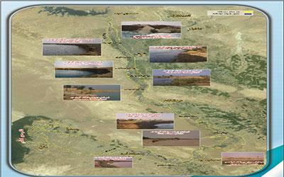
Studies of Karkheh River and its riparian from Karkhe Reservoir dam to Hawr-Al-Azim Wetland in the length of 300 km

Client: Ministry of Energy- Khuzestan Water and Power Authority
Project's Geographical Location: In the Scope of Karkheh River basin
Project Description:The Karkheh River with a length of 300 kilometers is one of the largest rivers in Iran. Karkhe River, after Karkheh Reservoir Dam, passes through different cities and after dividing into the two main branches of the Holsyan and Nissan, eventually leads to the Hawr-Al-Azim wetland.
The purpose of this study was to determine the area of Karkheh River and its branches. In these studies, MIKE 11 's computer model has been used to simulate floods with different return periods. All basic studies including hydrology and morphological studies, economic, social and legal studies, land use studies around the river and hydraulic studies have been completed. The land-use maps of the surroundings as well as the level of the river's riparian are also presented in the GIS environment.

