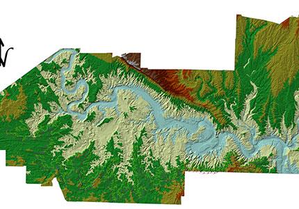
Map producing and marking 250 signs in the riparian of Karkhe dams storge in the length of 60 kilometer.

Marking of legal riparian of dam reservoirs including novel plans of Ministry of Energy which the first marking phase of Karkhe dam lake scope was conducted with the technical details in the below:
Reservoirs riparian border determining, at a distance of 150 meters of maximum High Water Mark, of the autoCAD reservoirs of Karkhe dam and designing position of benchmarks ( ropers) on the map
-
Obtaining spots positions at the distance of 300 meter and view establishing by utilizing GIS software
-
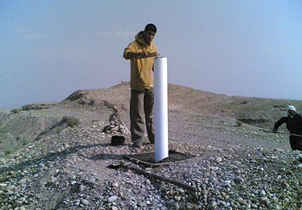
Creating ,establishing and installing of ropers according technical details in the scope of defined first phase
-
Determining spots positions by utilizing static satellite receivers DGPS
-
Coordination points executing by utilizing manual GPS receivers in the number of 250 points of preparing materials
-
Preparing and establishing of Global information systems (GIS)