The second stage studies of Sarriehs subsurface sub network irrigation and drainage network in Dasht Azadegan

Employer: JahadNasr Institute
Project Geographical Position: Khouzestan Province, Dasht Azadegan county , Sarrieh Village
Project Description:
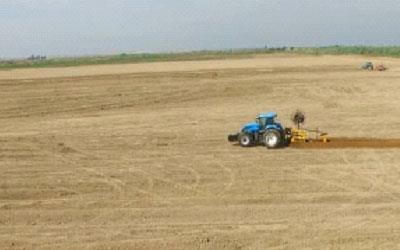
Sarrieh development unit with a breadth of 4200 ha. Which is located In the west of Jallaliye development and the south of Susangerd county. This unit is consist of 47 farmlands with a gross breadth of 33 to 167 ha. That is irrigated through 7 secondary drainage channals.
The engineering services of designing these networks are including of:
Designing of the main and sub network irrigation and drainage network in the lands with a net and gross breadth respectively 4227 and 3974 ha. Consist of sub network irrigation and drainage channels, land leveling, drainage pumping stations and drilling , designing and sedimenta of drainage channels CS 10R and CS11R, three subsurface drainage channels and other sub main structures which are describing in the following table:
| Operation description( length) | Values (KM) |
| Channels | 445 |
| Three grade drainage channels | 56.9 |
| Subsurface drainage | 765.5 |